We use cookies to personalise site content, social media features and to analyse our traffic. We also share information about your use of this site with our advertising and social media partners.
FEATURED
SPONSORED
VERIFIED
November 14, 2025 -
8 minutes, 21 seconds
-1.7K Views 99 Comments 0 Likes 0 Reviews
Disasters can happen through floods, hurricanes, earthquakes, wildfires, and can happen at any time and unannounced causing destruction. Time is of the essence in this window, even if it is just hours, to get warnings out to reduce disasters and save lives and communities from damage. This is where technology enters the equation.
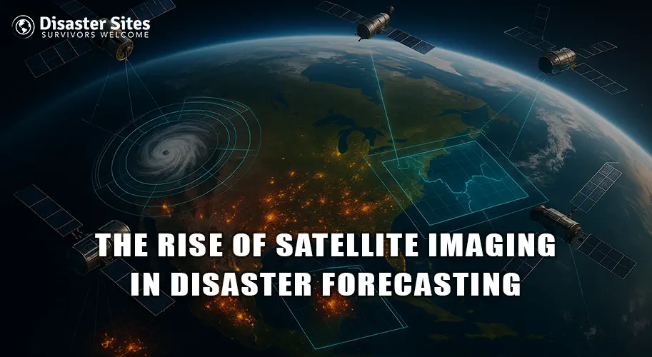
Lately, satellites have topped the list of natural disaster anticipation tools. With an overhead view of Earth events, natural scientists use satellite information to project weather disturbances, record land changes, or detect alarming signs of future disasters. This technology has transformed disaster management solutions and, in some cases, provided governments and communities with a better chance of preparation before the disaster hits.
Satellite imaging is the mapping of the Earth from space through special cameras or sensors attached to satellites. These images vary from static images that contain characteristics like changes in cloud movement, temperature, changes in water levels, or the quantity of greenery on land.
There are different types of satellites for the forecasting of disasters. For example, Weather satellites observe storms, rainfall, and track clouds. Remote Sensing satellites observe changes on the surface of the Earth such as floods, forest fires, or droughts. Scientists use both types of satellites to initiate a cohesive image of what was happening on Earth.
For a broader understanding of disaster tracking with technology, see Tracking and Managing Disasters With The Aid of Technology.
Satellite imagining is an important factor to predict and manage catastrophe. Because there is no other view point than from a satellite in space, satellites can detect atmospheric, land, and ocean changes much earlier than ground surface systems, therefore can deliver valuable real time activity, warning, and approvals.
For instance, satellites can detect the early formation of cyclones or hurricanes and track their movement; have been able to see heavy rain during the storm and rising water levels which may soon inundate the area. Satellites can detect heat spots and smoke early, for example in wildfires, before they become a big problem. Even during disasters satellites continue to monitor the situation in real time to provide emergency response teams information so they can plan and try to organize their rescue, and post disaster efforts.
Similar applications of satellite and real-time data monitoring have been used in events like Myanmar Earthquake 2025.
Satellite imaging has transformed disaster preparation by providing many benefits:
Satellite imaging has already demonstrated its usefulness in multiple actual uses:
For insights on using technology and apps for emergency preparedness, see 5 Ideas: The Functions of Mobile Apps in Preparation for Emergencies.
Satellite imaging is certainly powerful, but there are also challenges:
The future of satellite imaging in disaster management is bright. Satellite technologies are evolving so that satellites are becoming smaller, faster, cheaper, and new technologies such as AI and machine learning are being utilized to analyze satellite imagery, making predictions faster and better than ever before.
In some cases, there are groups of launches of small satellites (CubeSat) that will provide images of the world more frequently. The near real-time feedback for monitoring floods, storms, and wildfires is becoming more accessible and inclusive for developing countries as well in the next few years leading to havoc global preparedness for disasters.
As the future of satellite technology continues to improve both the monitoring aspect of disasters and guiding the recovery efforts will be tracked continually at near real-time.
Satellite imaging allows the more accurate predictions of disasters. For instance, satellites provide accurate forecasting of cyclones and floods, and fires can be mapped and detected, and earthquakes can be mapped. It becomes valuable to the public, scientists, and government agencies to aid in the response and save lives. Although there are still challenges such as cost and complexities of data, the fast moving pace of development of AI for satellite imaging, small satellites and the ability to tap into global information, gives satellite imaging unprecedented power and reach.

“To assist disaster survivors by providing a source for them to come together in time of need, to aid in the listing of events, information and other forms of assistance, and continuing support through the recovery process.”

Share this page with your family and friends.