We use cookies to personalise site content, social media features and to analyse our traffic. We also share information about your use of this site with our advertising and social media partners.
FEATURED
SPONSORED
VERIFIED
December 2, 2025 -
5 minutes, 50 seconds
-2.7K Views 331 Comments 0 Likes 0 Reviews
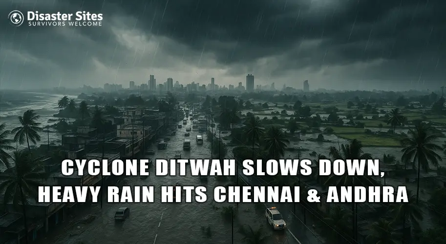
Heavy rain is still falling across Southern India today. Cyclone Ditwah has weakened, but it is now stuck very close to the coast of Tamil Nadu and Andhra Pradesh. Because the storm is moving so slowly, it is dumping a lot of water in one place.
This has caused flooding in Chennai and nearby areas. Authorities are working hard to clear the water. Here is what is happening right now.
The cyclone has weakened from a deep depression into a regular depression, but it is still hovering dangerously close to the coastline. Instead of moving inland quickly, it is moving at a very slow pace, causing intense, continuous rainfall over coastal and inland areas.
This slow movement is one of the main reasons for:
Weather experts say it may weaken further tonight, but scattered heavy showers will continue over the next 24–48 hours.
The Indian Meteorological Department (IMD) has issued a Red Alert for the following areas:
A Red Alert means very heavy to extremely heavy rainfall is expected, and people must stay indoors unless necessary. Local authorities are closely monitoring water levels and drainage systems in vulnerable areas.
Emergency helplines, disaster response teams, and rescue boats have been kept on standby.
Due to reduced visibility, strong winds, and waterlogged runways, several flights at Chennai International Airport have been delayed or cancelled. Train services in some coastal regions are running at slower speeds or have been halted for safety inspections.
Road travel is currently highly risky as:
If travel is necessary, then verify real-time road and flight status before leaving.
Severe waterlogging and flooding have been reported in:
In Andhra Pradesh, heavy rain warnings have been issued for:
Low-lying villages and coastal settlements are on high alert, and temporary shelters are ready for residents if evacuation becomes necessary.
In several flood-prone zones, electricity has been turned off as a precaution against electrocution and fire hazards. During heavy rainfall and flooding, water can conduct electricity through submerged wires and equipment, so power shutdowns are necessary to prevent accidents.
Additionally, floodwater can contaminate drinking sources. There is a high risk of waterborne diseases in the coming days.
These steps can save lives during extreme weather events.
According to weather experts, Cyclone Ditwah will weaken further as it drifts southward. However, due to the accumulated moisture in the system, chances of heavy intermittent rainfall remain high for the next 1–2 days.
This means:
Citizens are advised to stay alert and follow official warnings without delay.
Cyclone Ditwah may be weakening, but its impact is far from over. Continuous rains, flooding, closed roads, power cuts, and travel disruptions show that the situation still demands caution and awareness. The coming hours are critical for both government agencies and residents.
In times like these, staying informed through reliable sources and following safety advisories without panic or delay can make a huge difference. Your safety and your family’s safety depend on smart, calm decisions.
That is why Disaster Sites is here to help you in this critical time with real-time updates, expert tips, and resources for every disaster to may happen. For more information, visit us now and make your safety the utmost priority.

“To assist disaster survivors by providing a source for them to come together in time of need, to aid in the listing of events, information and other forms of assistance, and continuing support through the recovery process.”

Share this page with your family and friends.