
FEATURED
SPONSORED
VERIFIED
Aug 26 -
7 minutes, 24 seconds
-80 Views 0 Comments 0 Likes 0 Reviews
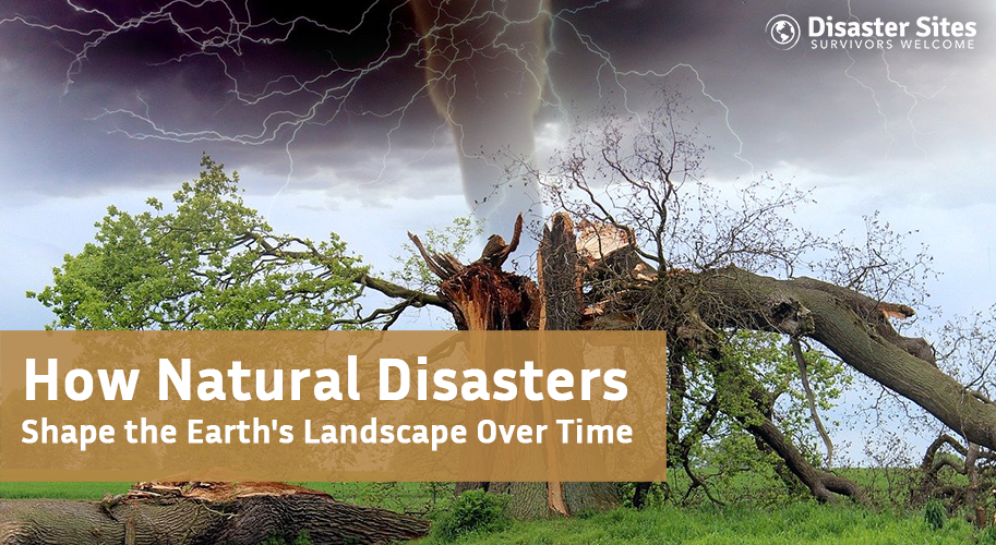
Natural phenomena such as tsunamis, earthquakes, floods and hurricanes have measurable effects on the morphology of the earth over time. The possible effects of these phenomena both positively and negatively are numerous. For instance, earthquakes and volcanoes create mountain ranges or rift valleys. Volcanic eruptions can produce islands or create land from ash deposits that promote growth and enrich soil. Floods change the location of riverbanks and can produce fertile alluvial plains with sediment deposits from flood waters. Hurricanes can landfall and erode coastlines and can change positions of barrier islands.
Though they are usually viewed as disastrous, these events are agents of change geologically and ecologically. They contribute to the constantly evolving scenery of the planet, our ecosystems, and potentially the migration of human and animal settlements. Understanding these aspects of natural disasters allows us to function more effectively when confronting disasters in the future, additional appreciation for part of our world that formed and continues to form for us here on this earth.
Earthquakes and tectonic processes are profound changes to our planet having unfolded over long periods of time. Earth has tectonic plates that shift and when these plates collide they create faults and rift zones that fracture the bedrock of the Earth. Lastly, tectonics can uplift land forming mountains or subside land forming valleys. Over millions of years, such forces result in radical landscape change.
In terms of the severity of natural disasters, volcanic eruptions rank among the most forceful and destructive on the surface of the earth. Volcanoes recycle solid rocks back to molten magma, it can form eruption clouds of ash and volcanic gases and can create new landforms! In fact, one of the major benefits of volcanic eruptions is the new landforms they create, underwater volcanic eruptions result in topography we now recognize as an entire island, such as Hawaiian Islands or Iceland, after an exterior crust forms that allows for immigrant species.
As magma cools and solidifies, mountain ranges, cone shaped mountains, and calderas are formed; these landforms add to the existing range of heights. Volcanoes spill ash and minerals over a great distance; then eventually weathering occurs and new soils form providing A & H natural deposits that are nutrient-rich for agricultural limits or otherwise biodiversity. Such places are bastions of biodiversity once stable after major events.
The connection between volcanic activity and climate impacts is explored in Melting Glaciers Could Wake Up Sleeping Volcanoes, highlighting how earth processes are interconnected.
Most often caused by an undersea earthquake, volcanic eruptions, or landslide, tsunamis are large surface waves in the ocean. Tsunamis can impact the coast and in a matter of minutes can unleash tremendous energy to change the land. With such power, water moves so fast that it can wash away beaches, uproot vegetation, and carry away sediment, changing land and seabed configuration.
Tsunamis can also alter the configuration of coastlines, removing land in a variety of ways (including permanently inundating land), carving new inlets, and even eroding natural barriers. Tsunamis can also remove sand, rock, and organic matter. This means that they have the ability to build one landform and remove it from another. All of these changes can severely impact marine environments and estuaries by disturbing food chains and habitats.
Key Points:
Glaciers, large, moving ice masses, are one of the most important and powerful natural forces of land change on Earth. Glaciers can take thousands to millions of years to eat mountains, shape deep U shaped valleys, and form beautiful glacial landforms such as bay and cirques. Glaciers pick up, and drag the hard rock below, as glaciers move forward they will carry that sediment with them, and when they retreat they create recognizable landforms which clarify the route of actual glacier movement.
Glaciers also change landforms, river systems, and even how soils are arranged, and how local climates change. For example, when glaciers melt, they supply surface water which impacts local hydrology and hydrologic systems. Glaciers influence the landscape with profound, sometimes long lasting traces, long after they have melted and changed course.
The accelerating effects of climate change on glaciers and landscapes are evident in Climate Crisis in Africa 2025 - Floods, Heatwaves, and Food Crisis, where warming trends reshape environments.
Natural disasters can be terrible, but they are also among the most formidable forces on our planet. Glaciers and their slow relentless carving of valleys; Earthquakes, avalanches, and landslides are constantly re-shaping the outer skin of the planet. They create dynamic landscapes that are ever changing. By knowing their processes, we can understand those landscapes we use and the ecosystems associated with those landscapes more. But more importantly, we can adapt, prepare, and do our best to cohabitate with the natural world that has created and continues to create our landscapes.
Our Mission... “To assist disaster survivors by providing a source for them to come together in time of need, to aid in the listing of events, information and other forms of assistance, and continuing support through the recovery process.”


Share this page with your family and friends.